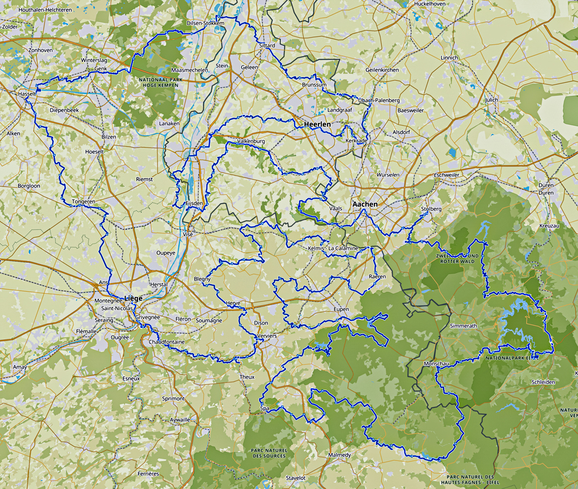
Start to cross-border!

This long-distance hiking and walking trail is as you can see above situated in the heart of the Euregio Meuse-Rhine (EMR), between the cities Maastricht (NL), Genk (BE), Hasselt (BE), Liège (BE), Eupen (BE) and Aix-La-Chapelle (DE).
With its 3 languages and 5 partner regions, the Euregio Meuse-Rhine (EMR) is the most versatile and complex region, but these regions are not at all as different as it might seem at first glance. Of course there are state and language borders, but historically, culturally and economically they are more related, as you will discover.
Depending on when you walk, each season will bring something different: in spring you will see lambs in the fields; in late summer, the meadows blooms with heather and gorse; autumn is a prime time to see mushrooms and migrating birds; and in winter, there’s nothing like walking in snow if you are lucky. Read more…
Overview map:

Stats:
| Total distance: | 916,1 kilometers |
| Total elevation up and down: | 13.040 meters |
| Highest point: | 699 meters at Signal de Botrange (BE) |
| Lowest point: | 23 meters at the banks of the river Meuse (NL) |
| Long-distance trail: | In 44 stages |
| Average stage distance: | 20,8 kilometers |
| Natural trail, path, gravel and dirt road: | 77,8% |
| Asphalt and road: | 22,2% |
| UNESCO heritage sites: | 12 |

