In 44 stages
Stage 1.
Stage 2.
Stage 3.

Maastricht (NL) to Meerssen (NL)
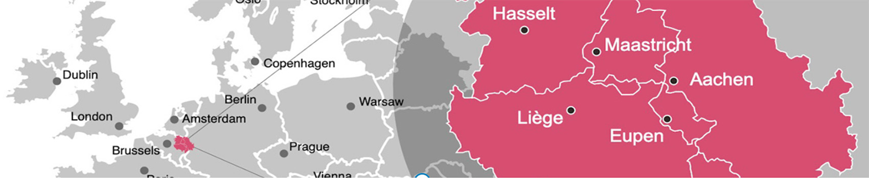
Maastricht is the start of the EMR Trail and you follow a part of the Roman trade route Via Belgica.
Total length 22,2 kilometers

Meerssen (NL) to Spaubeek (NL)
Meerssen was inhabited during Roman times. In 1865, a priest discovered remnants of a Roman villa.
Total length 20,6 kilometers

Spaubeek (NL) to Landgraaf (NL)
Spaubeek is village with a train station. Near the Sint-Laurentiuskerk (church) is a large square where you can park.
Total length 23,7 kilometers
Stage 4.
Stage 5.
Stage 6.

Landgraaf (NL) to Übach-Palenberg (DE)
Landgraaf is located in the province Limburg and is a young municipality in beautiful surroundings.
Total length 23,7 kilometers

Übach-Palenberg (DE) to Jabeek (NL)
Übach-Palenberg is located 20 km of Aachen at the frontier with the Netherlands.
Total length 18,6 kilometers

Jabeek (NL) to Born (NL)
Jabeek is a residential area in Beekdaelen. The name is derived from the stream Quabeek.
Total length 20,9 kilometers
Stage 7.

Born (NL) to Opglabeek (BE)
Born dates from the year 1125. The settlement Born arose on the northeast side near a water source.
Total length 21,0 kilometers
Stage 8.

Opglabeek (BE) to Genk (BE)
The Opglabbeek inhabitants lived from agriculture and turf extraction at the end of the 18th century. Today the turf extraction is gone.
Total length 18,7 kilometers
Stage 9.

Genk (BE) to Hasselt (BE)
Genk is a cosmopolitan city in the Belgian province Limburg with more than 66,000 inhabitants.
Total length 22,7 kilometers
Stage 10.

Hasselt (BE) to Wintershoven (BE)
Hasselt arose in the 7th century near the Helbeek. The name is probarly derived from Hasaluth, which means hazel forest.
Total length 20,7 kilometers
Stage 11.

Wintershoven (BE) to Tongeren (BE)
Winterhoven is located at Roman main road to Tongeren. Roman roof tiles were used for the Sint-Pietersbandenkerk.
Total length 17,4 kilometers
Stage 12.

Tongeren (BE) to Liège (BE)
Tongeren is the oldest city in Belgium. The most famous inhabitant of Tongeren is undoubtedly the Eburone king Ambiorix.
Total length 21,3 kilometers
Stage 13.

Liège (BE) to Chaudfontaine (BE)
Liège is located at the river Meuse. Romans inhabited Liège in the center of of the city at Place Saint-Lambert.
Total length 14,4 kilometers
Stage 14.

Chaudfontaine (BE) to Pepinster (BE)
Chaudfontaine is a town at the river Vesdre near Liège. The place gave its name to the spring water.
Total length 19,7 kilometers
Stage 15.

Pepinster (BE) to Herve (BE)
The city Pepinster traditionally had many watermills, due to its location between two fast-flowing rain rivers.
Total length 17,8 kilometers
Stage 16.

Herve (BE) to Aubel (BE)
Herve gave its name to the surroudings. The Land of Herve are villages that stretches between Meuse and Vesdre.
Total length 24,8 kilometers
Stage 17.

Aubel (BE) to Fouron-Saint-Martin (BE)
Aubel is best known for its regional products: Herve cheese, syrup, cider and beer. These are traded on the local markets.
Total length 19,3 kilometers
Stage 18.

Sint-Martens-Voeren (BE) to Teuven (BE)
The village Fouron-Saint-Martin is located in the valley of the stream Voer. After the French period, this village became Belgian.
Total length 21,4 kilometers
Stage 19.

Teuven (BE) to Calamine (BE)
Teuven mains income was agriculture. In 1850 the conversion to farming began. There is no industry.
Total length 19,8 kilometers
Stage 20.

Kelmis (BE) to Raeren (BE)
Kelmis (La Calamine) is located at the frontier between Belgium and is grown around the Altenberg zinc mine.
Total length 19,8 kilometers
Stage 21.

Raeren (BE) to Henri-Chapelle (BE)
Raeren is a German-speaking city in the province of Liège in Belgium and has more than 10,000 inhabitants.
Total length 23,3 kilometers
Stage 22.

Henri-Chapelle (BE) to Limbourg (BE)
Henri-Chapelle is a Belgian village in the province of Liège. Located 17 kilometers from the frontier of Aachen. And they speak french.
Total length 23,7 kilometers
Stage 23.

Limbourg (BE) to Eupen (BE)
Limbourg was founded in the year 1000. The city had a reputation for being impregnable and strategic of great value.
Total length 13,8 kilometers
Stage 24.

Eupen (BE) to Eupen (BE)
Eupen is the capital of East Belgium in the province of Liège and at the frontier of Nature Reserve Hautes Fagnes.
Total length 26,3 kilometers
Stage 25.

Eupen (BE) to Jalhay (BE)
Eupen is the capital of East Belgium in the province of Liège and at the frontier of Nature Reserve Hautes Fagnes.
Total length 15,8 kilometers
Stage 26.

Jalhay (BE) to Spa (BE)
Jalhay is located at the Nature Reserve Hautes Fagnes and has countless possibilities for walks in the Hertogenwald.
Total length 15,3 kilometers
Stage 27.

Spa (BE) to Hockai (BE)
The city Spa is located in the province of Liège. The thermal baths of Spa are listed as UNESCO World Heritage.
Total length 20,1 kilometers
Stage 28.

Hockai (BE) to Signal de Botrange (BE)
Hockai is one of the highest villages of Belgium and situated in the far north of Stavelot in the province of Liège.
Total length 21,1 kilometers
Stage 29.

Signal de Botrange (BE) to Bütgenbach (BE)
Try to climb the stairs of the monument of Signal de Botrange, you can reach above 700 meters. Highest point of Belgium.
Total length 23,3 kilometers
Stage 30.

Butgenbach (BE) to Hellental (BE)
Bütgenbach is located in the German-speaking of Belgium. In 1932 a dam was built and Lake Bütgenbach was created.
Total length 24,2 kilometers
Stage 31.

Hellental (BE) to Monschau (BE)
Hellenthal is located on the edge of the Eifel National Park and the Oleftalsperre is one of the largest reservoirs in Germany.
Total length 24,3 kilometers
Stage 32.

Monschau (BE) to Einruhr (DE)
Monschau is located in the most beautiful regions of Germany; the Eifel. Monschau was first mentioned in 1198 as Mons Ioci.
Total length 16,7 kilometers
Stage 33.

Einruhr (DE) to Heimbach (DE)
Einruhr is at the eastern bank of Rurtalsperre Schwammenauel and part of the municipality of Dedenborn.
Total length 23,9 kilometers
Stage 34.

Heimbach (DE) to Woffelsbach (DE)
Heimbach; the towers of Hengebach castle reigns over over the valley. The first mention of Heimbach was in 673. And is situated at lake Rursee.
Total length 15,3 kilometers
Stage 35.

Woffelsbach (DE) to Simonskall (DE)
Woffelsbach the village is located in the northern Eifel at the banks of the lake Rur, that flows into the river Meuse (NL).
Total length 21,5 kilometers
Stage 36.

Simonskall (DE) to Breinig (DE)
Simonskall started as a small settlement with the presence of iron ore, especially around the village Schmidt.
Total length 24,9 kilometers
Stage 37.

Breinig (DE) to Stolberg (DE)
Breinig is today characterised by its urban value and the careful preservation of its historic buildings.
Total length 20,1 kilometers
Stage 38.

`Stolberg (DE) to Aachen (DE)
Stolberg is a historic old town with an impressive castle complex, three old town and pre-industrial homes.
Total length 18,6 kilometers
Stage 39.

Aachen (DE) to Epen (NL)
Aachen is founded on the remains of Roman baths. The Latin word aqua can be taken as the origin of the name.
Total length 22,2 kilometers
Stage 40.

Epen (NL) to Simpelveld (NL)
Epen is derived from a Germanic word of possibly Celtic origin, “apa”, a word meaning “water”.
Total length 24,4 kilometers
Stage 41.

Simpelveld (NL) to Valkenburg a/d Geul (NL)
In 1930 some sandstone coffins from the Roman era were excavated.
Total length 21,7 kilometers
Stage 42.

Valkenburg a/d Geul (NL) to Margraten (NL)
Around the 19th century tourism developed as a new source of income.
Total length 21,3 kilometers
Stage 43.

Margraten (NL) to Eijsden (NL)
Margraten is international known by the presence of the Netherlands American Cemetery and Memorial, a large military cemetery.
Total length 24,7 kilometers
Stage 44.

Eijsden (NL) to Maastricht (NL)
Eijsden lies on the frontier with Belgium and on the banks of the river Meuse in the extreme southwest of the Dutch region Zuid-Limburg.
Total length 23,9 kilometers