Stage 10. Hasselt (BE) to Wintershoven (BE)

As a small settlement arose Hasselt around the 7th century near the Helbeek (stream), a tributary of the river Demer. The name Hasselt is probarly derived from the Germanic Hasaluth, which means hazel forest.
After the decline of the textile industry, the economy of Hasselt turned to brewing beer and distiling jenever. At some time around 1844 there were 24 distilleries. During the second half of the 19th century this industry grew into an industrial activity and from 1860 the Hasselt jenever was even exported. The construction of the Albert Canal (1930-1939) in the direction of Liège provided as well new impulses.
The Roman presence is apparent from the fact that the main road to Tongeren goes through the territory of what later became Wintershoven in a southerly direction. Roman roof tiles, potsherds and flints were used for the Sint-Pietersbandenkerk in Wintershoven.
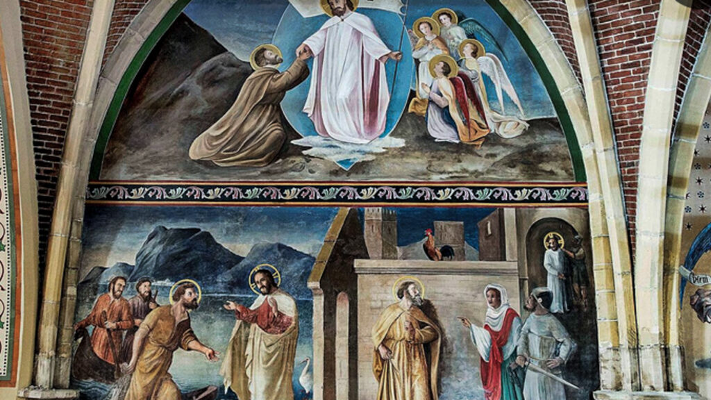
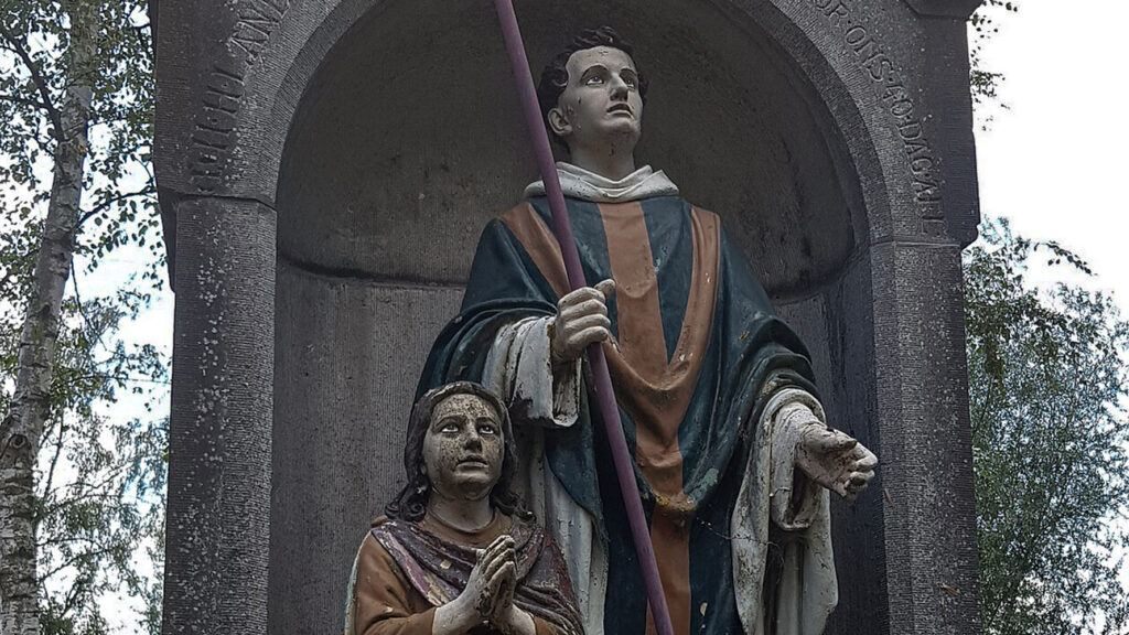
In the early Middle Ages, Wintershoven became an important ecclesiastical center due to the activities of religious preachers such as Bavo van Gent, Amandus and their followers in the 7th century. Many of them were canonized (the Saints of Wintershoven).
Wintershoven is the village of many saints. Every year, on November 1 and 2, many believers gather in the village for high mass. Then the relics of the saints from the seventh century are shown.
Wintershoven is located at a crossroads of roads, originally developed as a street village. In 1904 the tram line Kortessem-Tongeren was built, with a tram station near Dessener Castle. The tram line has disappeared, but the name Stationsstraat remained.
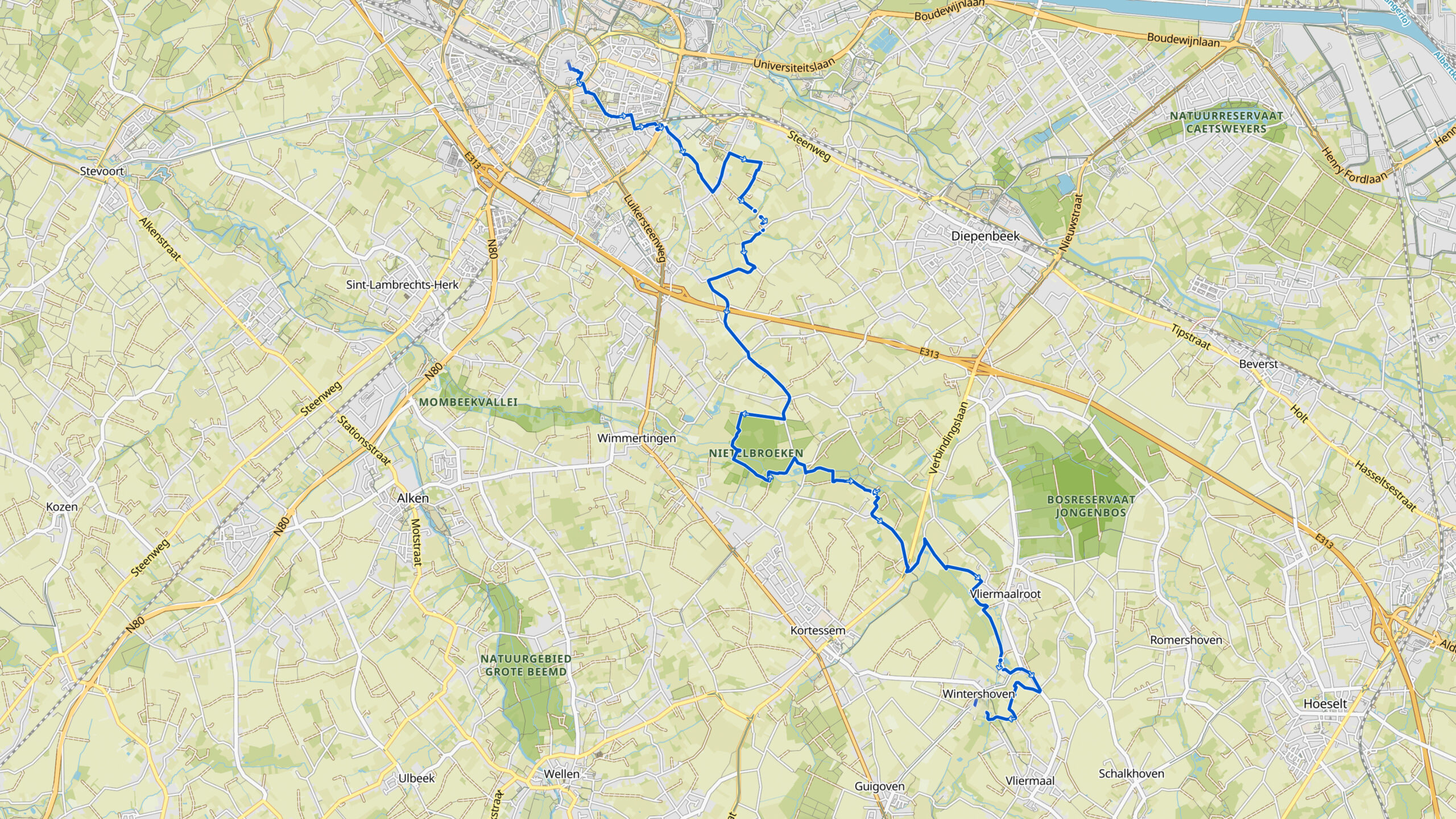
Overview map:
Stats:
| Start: | Fruitmarkt 11, 3500 Hasselt, Belgium |
| Coordinates (DD): | 50.930101 / 5.338455 |
| End: | Sint-Lambertusstraat, 3722 Wintershoven, Belgium |
| Coordinates (DD): | 50.851600 / 5.419116 |
| Distance: | 20,7 kilometers |
| Uphill: | 100 meters |
| Downill: | 90 meters |
| Path, dirt road, gravel, nature trail: | 86% |
| Asphalt, road: | 14% |
| More additional info like GPX track: | Go to Komoot* page here… (external) |
| Print: | Click for download here… (pdf) |
- *Komoot is a navigation and route-planning app that enables you to create and follow routes that are based on walking/riding type and ability. Be aware you have to sign up for free to have access to the app.
See and share with QR code:

You will see stage 10. when you scan the QR code (In the app Komoot).
Highlights:

Specific local info:


Roman history
Magnus Carolus
Water sources


Nature
WW1
WW2


Local products
Stories
Sleeping suggestions
Public transport:
Industrial heritage:

