Stage 25. Eupen (BE) to Jalhay (BE)

Eupen is the capital of East Belgium in the Belgium province of Liège and at the frontier Nature Reserve Hautes Fagnes in the Belgian Ardennes.
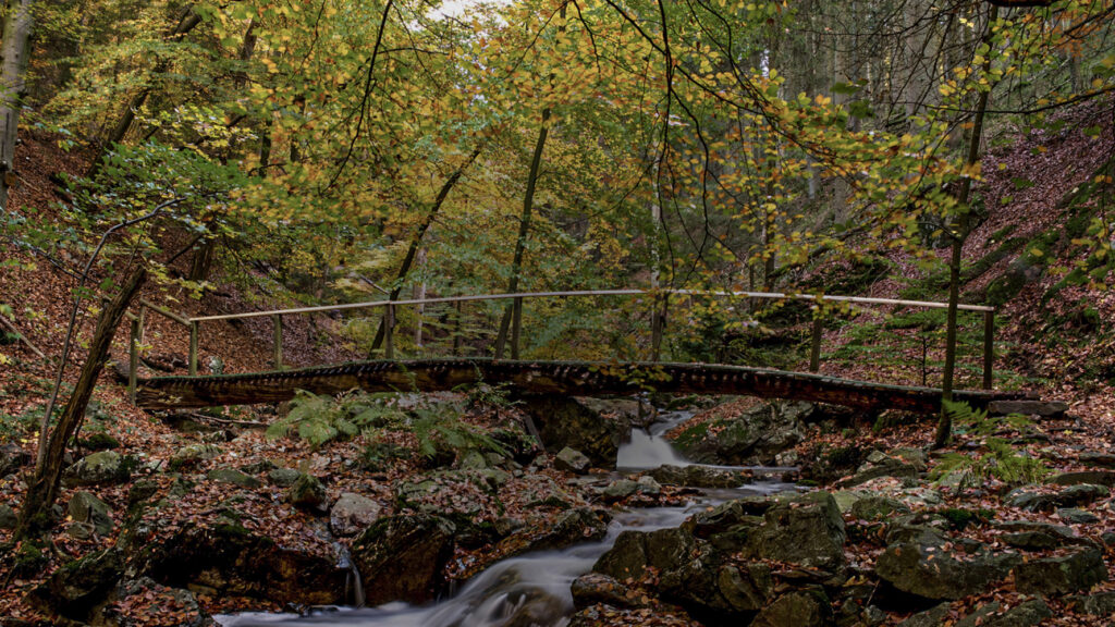
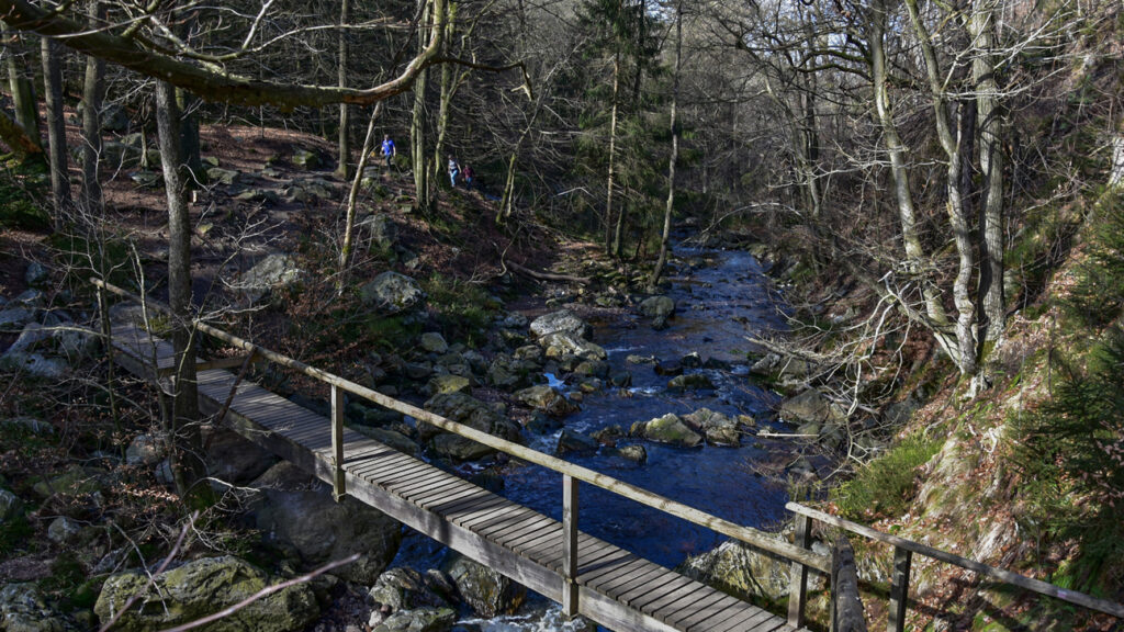
Jalhay is located at the gateway to the Nature Reserve Hautes Fagnes and has countless possibilities for walks in the Hertogen forest along the streams through splendid landscapes and exceptional nature.
At the restaurants and brasseries you can taste the regional cuisine such as cabbage or Jalhay black pudding and of course game in autumn.
Three to four centuries ago the Platdietse (Limburg) dialect was spoken in Jalhay. Inhabitants of the Dutch Valkenburg aan de Geul could understand the dialect but nowadays Jalhay is a French-speaking village.
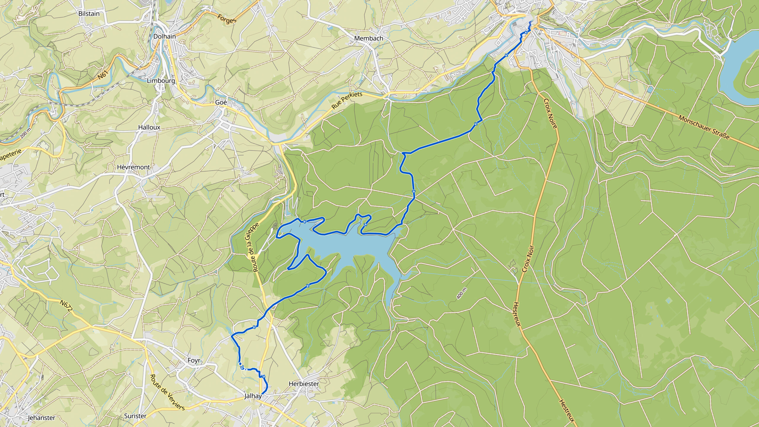
Overview map:
Stats:
| Start: | Eupen (BE) |
| Coordinates (DD): | 50.633030 / 6.043431 |
| End: | Jalhay (BE) |
| Coordinates (DD): | 50.558994 / 5.965489 |
| Distance: | 15,8 kilometers |
| Uphill: | 310 meters |
| Downhill: | 190 meters |
| Path, dirt road, gravel, nature trail: | 62% |
| Asphalt, road: | 38% |
| More additional info like GPX track: | Go to Komoot* page here… (external) |
| Print: | Go for download here… (pdf) |
- *Komoot is a navigation and route-planning app that enables you to create and follow routes that are based on walking/riding type and ability. Be aware you have to sign up for free to have access to the app.
See and share with QR code:

You will see stage 25. when you scan the QR code (In Komoot).
Highlights:
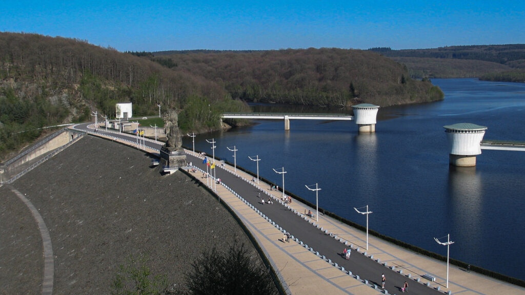
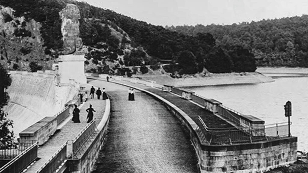
The Gileppe Dam (French: Barrage de la Gileppe) is located in the municipality of Jalhay. The supply of water is ensured by the Nature Reserve Hautes Fagnes. The original wall was the oldest concrete dam wall in Europe. The complex was officially opened by King Leopold II of Belgium on July 28, 1878.
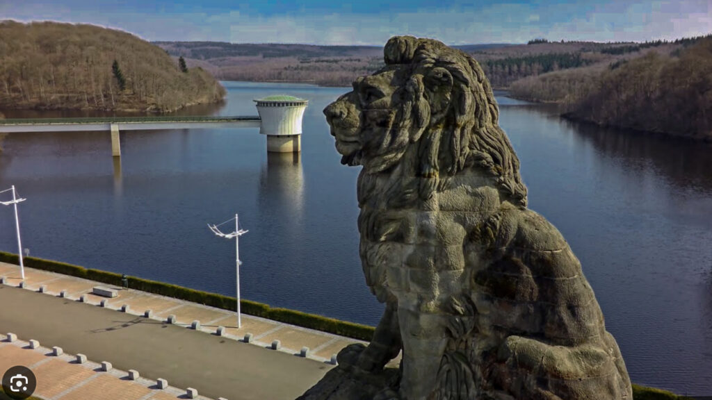
The main feature of the dam is a 13.5 meters high and 130 tons heavy sandstone lion. This lion stands on top of the dam wall and in contrary to what you might have thought, the 13 meter high lion does not look to the side of the lake – towards its own land -, but it looks towards the German frontier, which is only 10 km away. It turns out that King Leopold II did this consciously and deliberately. Actually, this lion is a gigantic raised middle finger to Prussia. You just have to dare. “Il faut le faire”.
The original purpose of the dam was to provide usable water for the textile industry in the vicinity of Verviers. In the period 1968-1971 the dam was raised by more than 10 m. Since then, the capacity of the lake has reached 26.5 million m³ on an area of 130 ha.
Specific local info:


Roman history
Magnus Carolus
Water sources


Nature
WW1
WW2


Local products
Stories
Sleeping suggestions
Public transport:
Industrial heritage:

