Stage 30. Bütgenbach (BE) to Hellental (DE)

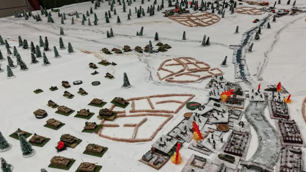
Bütgenbach (Province Liège) is located in the German-speaking eastern part of Belgium and has more than 5,500 inhabitants. In 1795 Bütgenbach was annexed by the French and in 1815 it became Prussian. In 1920, Bütgenbach was given to Belgium in accordance with the Treaty of Versailles. In 1932 a dam was built in the river Warche and Lake Bütgenbach was created. In the winter of 1944, General Eisenhower was stationed here for a few days during the Battle of the Bulge.
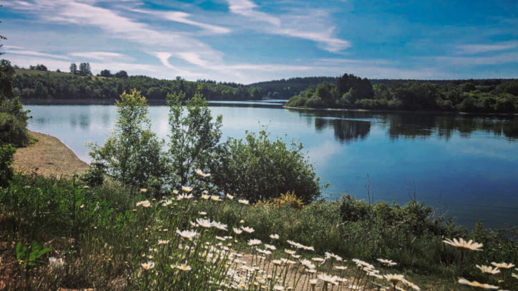
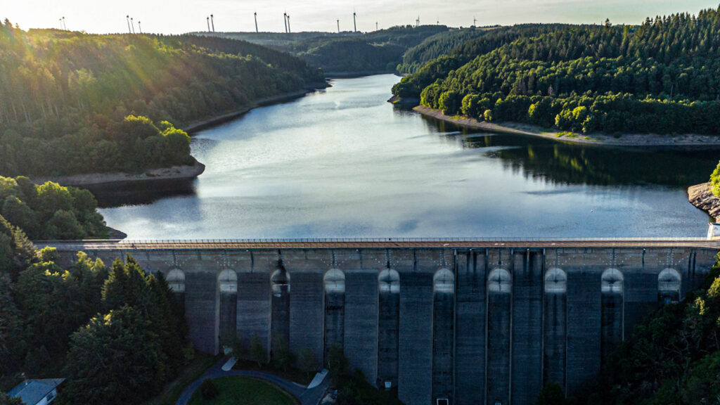
Hellenthal has 8000 inhabitants and the mostsouthern municipalty of Nordrhein-Westfalen and consists of 60 villages. Hellenthal is located on the edge of the Eifel National Park and the Oleftalsperre is one of the largest reservoirs in Germany. The reservoir contains about twenty million cubic meters of water and is fed by the river Olef, a tributary of the Urft that flows through both Belgian and German territory. The dam protects the surrounding municipalities against high water and is used for drinking water extraction. The reservoir is completely surrounded by forests.
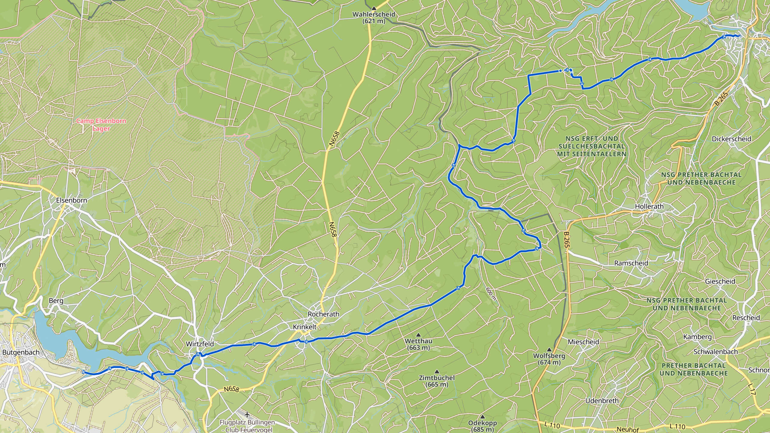
Overview map:
Stats:
| Start: | Butgenbach (BE) |
| Coordinates (DD): | 50.430058 / 6.209715 |
| End: | Hellental (DE) |
| Coordinates (DD): | 50.491701 / 6.434909 |
| Distance: | 24,2 kilometers |
| Uphill: | 350 meters |
| Downhill: | 490 meters |
| Path, dirt road, gravel, nature trail: | 60% |
| Asphalt, road: | 40% |
| Gpx track: | Go to Komoot* page here… (external) |
| Print: | Go for download here… (pdf) |
- *Komoot is a navigation and route-planning app that enables you to create and follow routes that are based on walking/riding type and ability. Be aware you have to sign up for free to have access to the app.
See and share with QR code:
You will see stage 30. when you scan the QR code (In the app Komoot).
Highlights:
Specific local info:


Roman history
Magnus Carolus
Water sources


Nature
WW1
WW2


Local products
Stories
Sleeping suggestions
Public transport:
Touristen Service:
Touristen Service:
