Stage 32. Monschau (DE) to Einruhr (DE)

In the north of the Eifel, not far from the border with Belgium, Monschau is located in one of the most beautiful regions of Germany; the Eifel. Monschau was first mentioned in 1198 as Mons Ioci. The castle probably originated from the 13th century and was founded by the Duke of Limburg as Castrum in Munioie. In 1352 the place received city rights. So Monschau is an old city whose history goes a long way back.
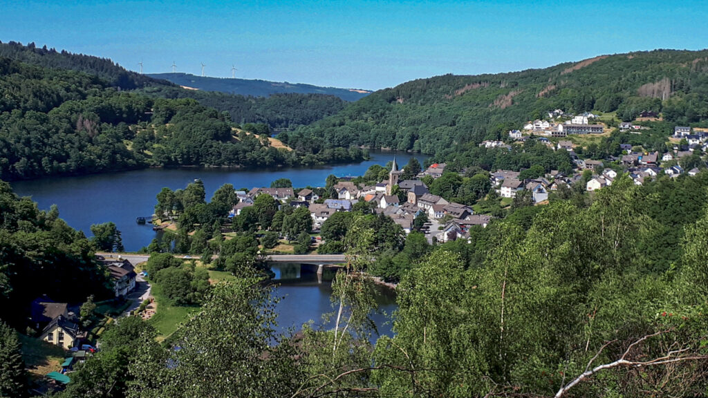
On the eastern bank of the Rurtalsperre Schwammenauel/dam is located the city Einruhr and part of the municipality of Dedenborn.
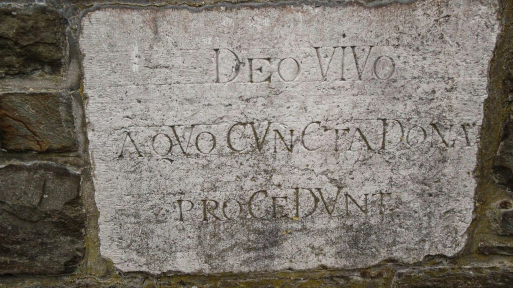
A Roman road Via Mansuerisca ended in Einruhr, which led from the Hautes Fagnes via Monschau, Konzen, Simmerath and Kesternich. Archaeological finds from the 2nd and 3rd centuries AD indicate Roman habitation in this area.
In 1470 the area; Monschauer Land belonged to the Duke of Jülich. And a farming settlement called Einruhr had arisen and after the enlargement of the Rursee the revival of tourism provided a new source of income for Einruhr.
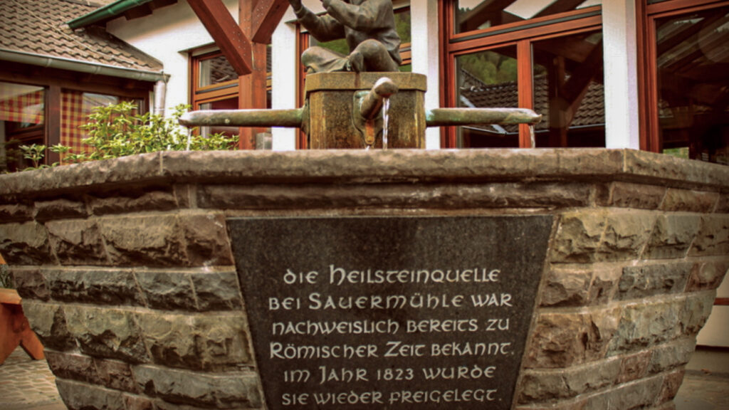
Heilsteinbrunnen is located in the center of Einruhr. This is a spring that raises water from a depth of 43 meters and was discovered in 1826. Due to the discovery of Roman coins, it is possible that the Romans were already drawing water here. In the Second World War little damage was done to the town, because it was too far from the Westwall. Only the church was destroyed.
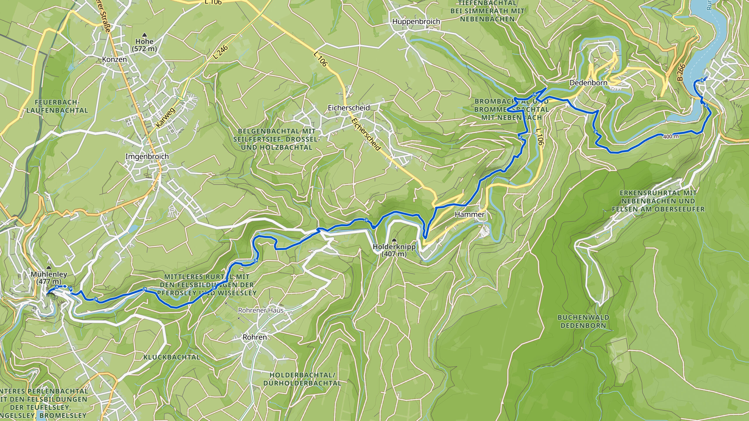
Overview map:
Stats:
| Start: | Monschau (DE) |
| Coordinates (DD): | 50.491837 / 6.441756 |
| End: | Einruhr (DE) |
| Coordinates (DD): | 50.584478 / 6.380478 |
| Distance: | 16,7 kilometers |
| Uphill: | 480 meters |
| Downhill: | 600 meters |
| Path, dirt road, gravel, nature trail: | 95% |
| Asphalt, road: | 5% |
| More additional info like GPX track: | Go to Komoot* page here… (external) |
| Print: | Go for download here… (pdf) |
- *Komoot is a navigation and route-planning app that enables you to create and follow routes that are based on walking/riding type and ability. Be aware you have to sign up for free to have access to the app.
See and share with QR code:

You will see stage 32. when you scan the QR code (In the app Komoot).
Highlights:
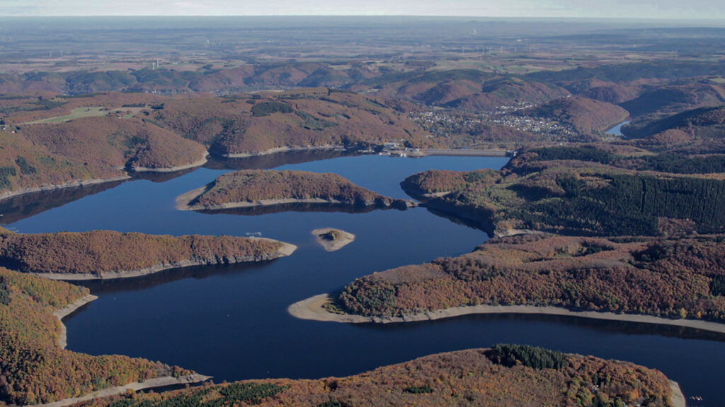
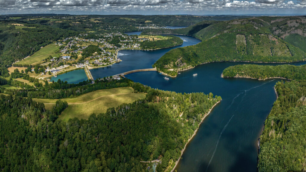
The Rurtalsperre Schwammenauel/dam
was built between 1934 and 1938. It was inaugurated in 1939. The dam is made of stones and soil, between which there is loam, read more…
Towards the end of the Second World War, the river Rur was located in the front area between the German troops and the Allied troops. On February 10, 1945, German troops sabotaged the valves of the dam, so that the reservoir emptied. This caused high water downstream in the river Rur, causing Allied operations to be delayed by two weeks. Between 1955 and 1959 the dam was raised by twenty meters to the current 77 meters above the old bed of the river. This considerably expanded the surface of the lake, as far as the town of Einruhr.
Specific local info:


Roman history
Magnus Carolus
Water sources


Nature
WW1
WW2


Local products
Stories
Sleeping suggestions
Public transport:
Industrial heritage:

