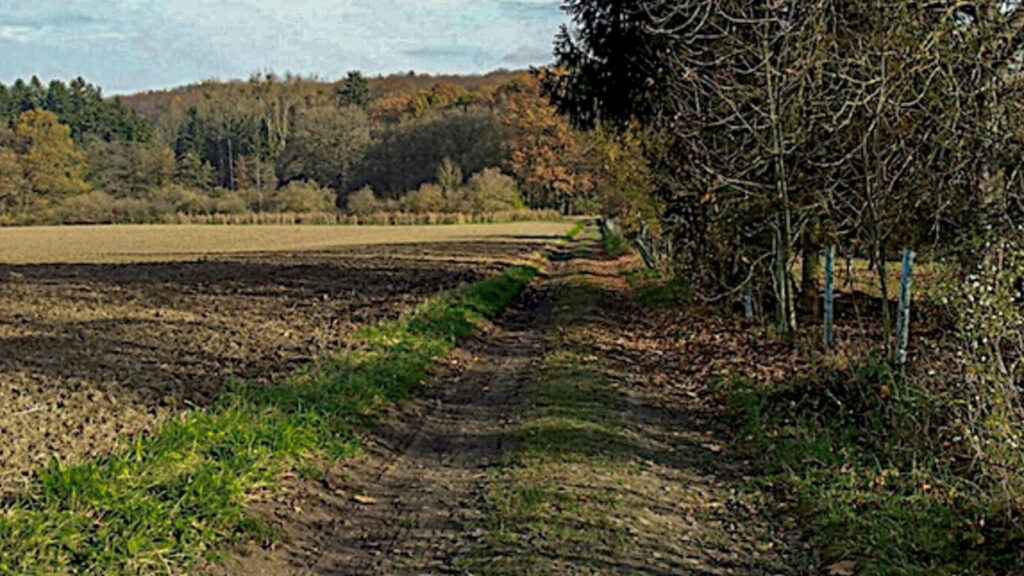
Stage 35. Woffelsbach (DE) to Simonskall (DE)

Woffelsbach is a village of about 500 inhabitants of the municipality Simmerath. The village is located in the northern Eifel on the banks of the lake Rur, that flows into the river Meuse (NL).
The area in which Woffelsbach is located has been inhabited since Roman times, this is supported by archaeological. Little is known about the beginning of the current Woffelsbach. The oldest farms date from the seventeenth century. In 1794 the Woffelsbach was occupied by French revolutionary troops. The French occupation lasted until 1815 when the territory was assigned to the Kingdom of Prussia.
Tourism in Woffelsbach started in the 1930s and received an enormous boost with the construction of the dam between 1955 and 1959. This created the possibilities for water sports that had not been available before.
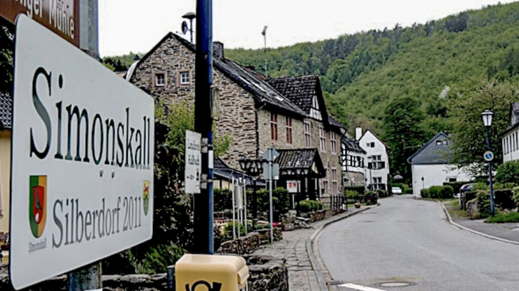
Simonskall is a place with the special name: “Die Perle der Eifel”. Hidden deep in the Kalltal lies the idyllic hamlet, consisting of a few old half-timbered houses, a dilapidated water mill and a small chapel. And on top of that, fortunately or unfortunately, a large number catering establishments.
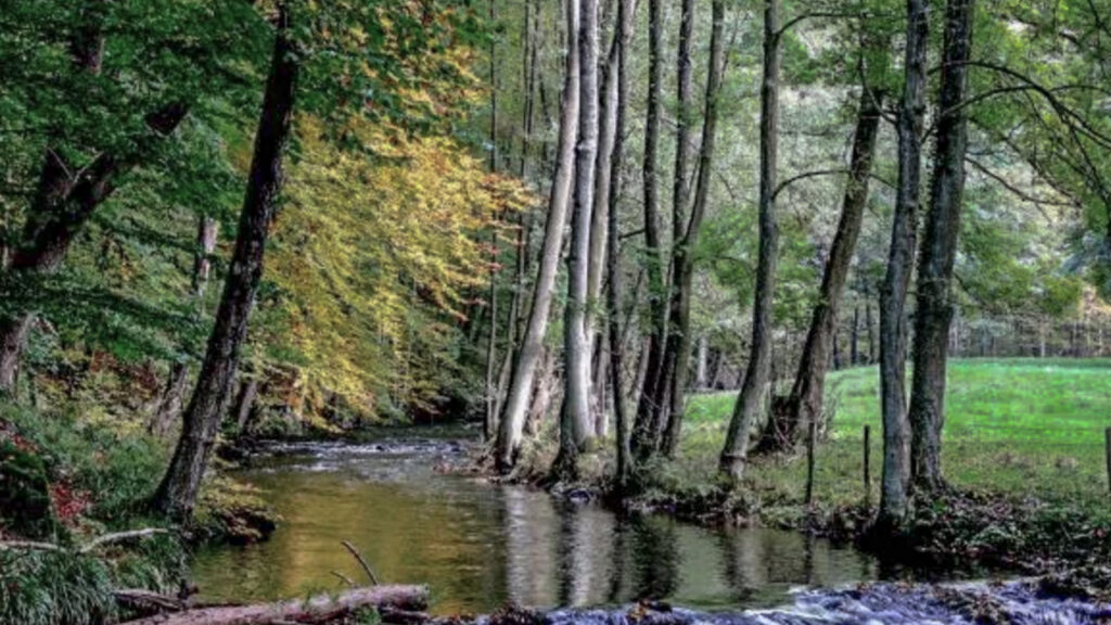
Simonskall with 32 inhabitants used to be a small settlement and the presence of iron ore, especially around the village Schmidt, hydropower from the stream Kall a tributary of the river Rur and charcoal from the surrounding forests made Simonskall one of the most important industrial villages in the Monschau country.
In 1643 a fortified house was built in Simonskall, which bears the name “die Burg“. This building is located directly on the Kall stream and consists of a farm part and a residential house with a square courtyard. Iron was produced from here and delivered to the weapon factories of Liège.
In 1900, tourism started to emerge and the Rast- and Kaffeehaus was built. Today exhibitions are regularly held in the current “Haus des Gastes“. For example, there is a permanent collection about WW2.
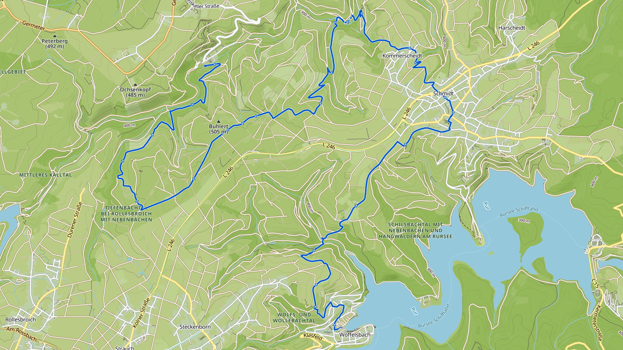
Overview map:
Stats:
| Start: | Woffelsbach (DE) |
| Coordinates (DD): | 50.627794 / 6.384539 |
| End: | Simonskall (DE) |
| Coordinates (DD): | 50.666152 / 6.351446 |
| Distance: | 21,5 kilometers |
| Uphill: | 620 meters |
| Downhill: | 600 meters |
| Path, dirt road, gravel, nature trail: | 83% |
| Asphalt, road: | 17% |
| More additional info like GPX track: | Go to Komoot* page here… (external) |
| Print: | Go for download here… (pdf) |
- *Komoot is a navigation and route-planning app that enables you to create and follow routes that are based on walking/riding type and ability. Be aware you have to sign up for free to have access to the app.
See and share with QR code:

You will see stage 35. when you scan the QR code (In the app Komoot).
Highlights:
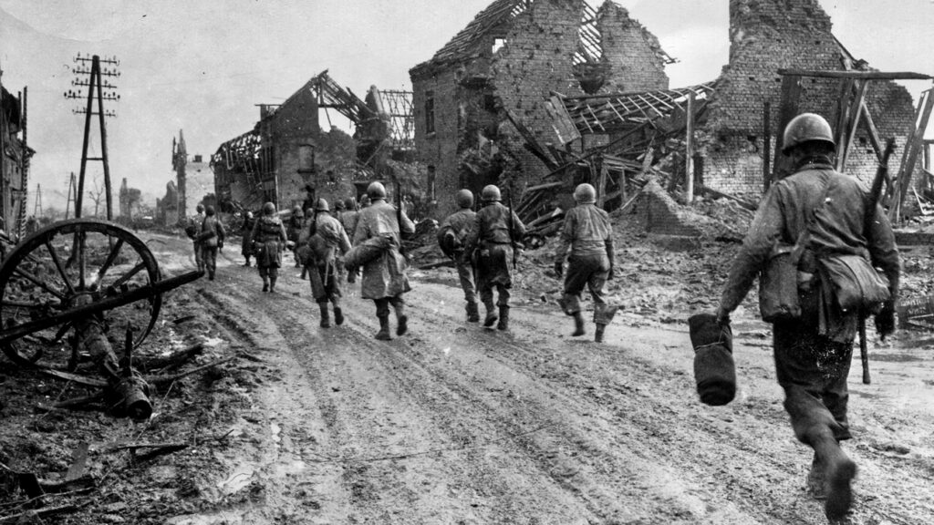
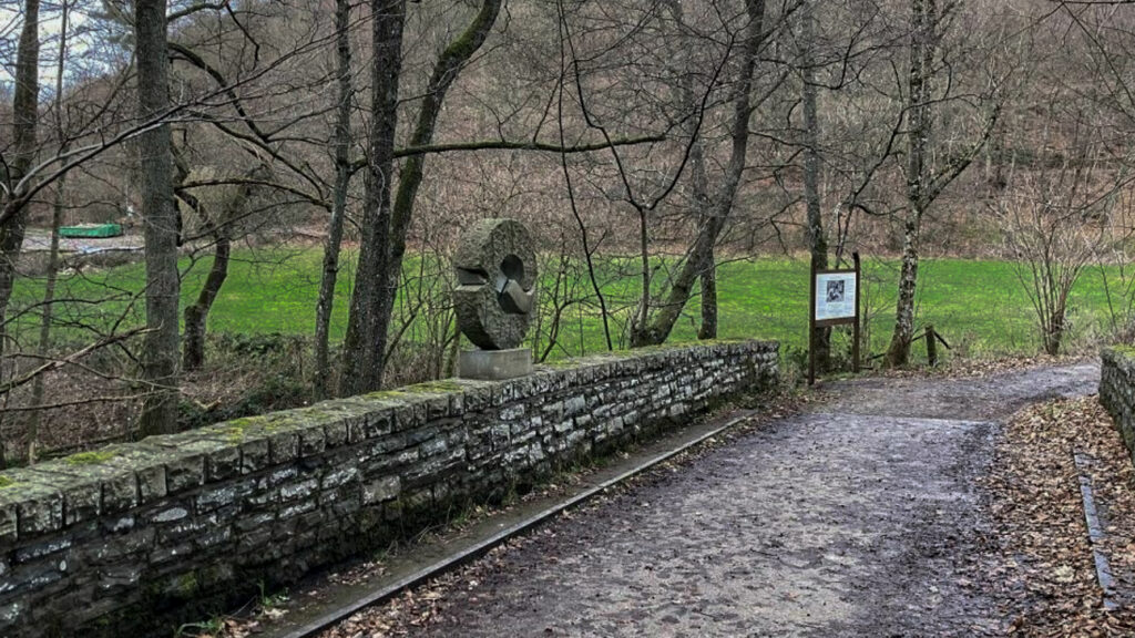
The memorial “A Time for Healing” is located on the bridge over the stream Kall near the restaurant Mestrenger Mühle; Around this bridge was heavily fought over at the Battle of the Hürtgen Forest during WW2, read more…
At this bridge has been decided several times during WW2 for a cease-fire to take care for the wounded. Anyone who has ever heard of the Hürtgen forest in the Eifel will usually associate it with WW2. Hürtgen Forest was nicknamed the “Meat Grinder or Death Factory“.
t the end of 1944, a heavy battle took place, along the Westwall (Siegfriedline) between the Allies (Americans) and the German army.
There were unbelievably great losses, mainly on the American side. More than 60,000 soldiers died as a result of gross errors of judgment, poor tactics and bitter resistance from the Germans.
Traces of the battle – old bunkers, munitions, trenches and tank tracks – are still visible even today.
Perhaps that is why this battle of the “Hürtgen forest” is less well known than the “Battle of Arnhem” or the “Ardennes Offensive“. This painful chapter would rather be forgotten.
Specific local info:


Roman history
Magnus Carolus
Water sources


Nature
WW1
WW2


Local products
Stories
Sleeping suggestions
Public transport:
Industrial heritage:

