Stage 36. Simonskall (DE) to Breinig (DE)

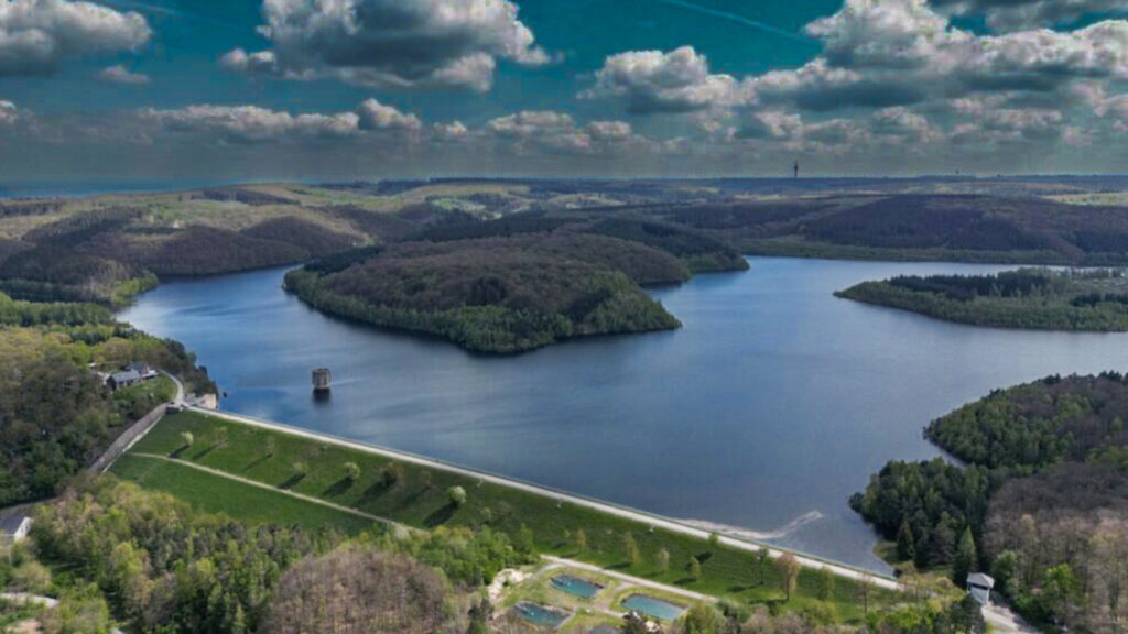
Simonskall started as a small settlement with the presence of iron ore, especially around the village Schmidt, hydropower from the stream Kall a tributary of the river Rur and charcoal from the surrounding forests made Simonskall one of the most important industrial settlements in the Monschau country.
Ore was mined in Breinig as early as Roman times in primitive smelting plants. And a Roman road from northern France via Belgium to Cologne touched Breinig.
Mining brought Breinig a modest prosperity. At times up to 700 ore workers worked in the area of the Schlangenberg (now a nature reserve).
In 1880 the Stolberg-Walheim railway line was built by Breinig and in 1889 the Breinig train station which is now a listed building.
Until 1922, ore was mined in the Cornelia ore mine in the Breiniger Heide area. Many Breinigers worked in the lead and zinc smelters.
On September 14, 1944 US tanks advanced into Breinig.
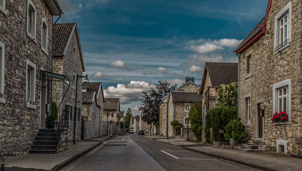
Old Breinig is is today characterised by its urban value and the careful preservation of its historic buildings. The entire old Breinig street is therefore listed as historic town centers and designated as a particularly regionally typical place.
The buildings in the historic centre were mainly built with bluestone from the local quarry,
The historic centre of the village is a vital and lively residential area. Nestled in the idyllic surroundings, characterised by cattle meadows and wooded areas, renaturalised streams and former quarries with rugged and moss-covered cliffs. Breinig is strongly promoted by local tourism.
From here the view opens up into the wooded Nature Park Hohes Venn-Eifel around Germany’s youngest national park: the Eifel National Park.
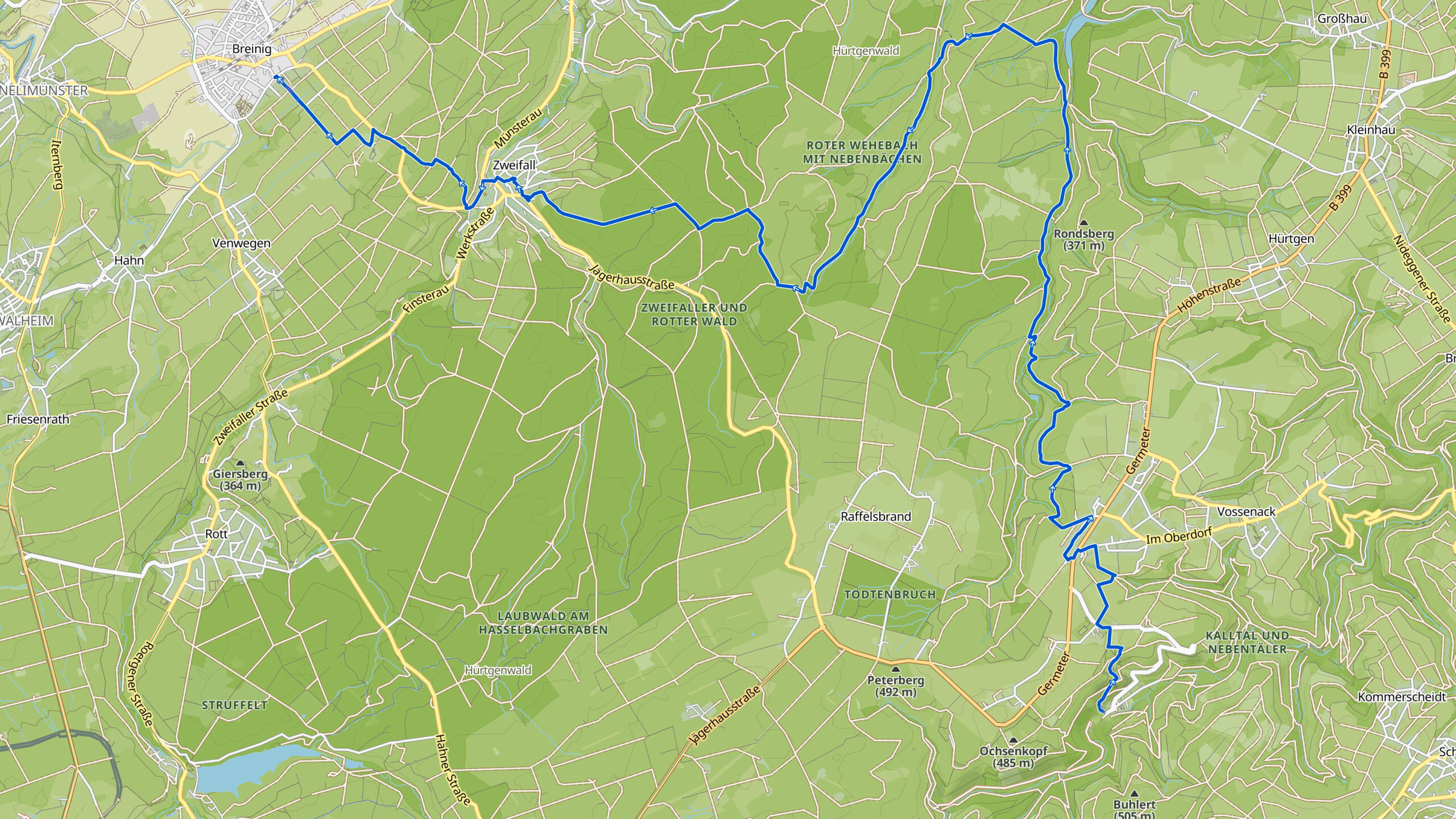
Overview map:
Stats:
| Start: | Simonskall (DE) |
| Coordinates (DD): | 50.666152 / 6.351446 |
| End: | Breinig (DE) |
| Coordinates (DD): | 50.729983 / 6.220672 |
| Distance: | 24,9 kilometers |
| Uphill: | 440 meters |
| Downhill: | 470 meters |
| Path, dirt road, gravel, nature trail: | 93% |
| Asphalt, road: | 7% |
| More additional info like GPX track: | Go to Komoot* page here… (external) |
| Print: | Click Go for download here… (pdf) |
- *Komoot is a navigation and route-planning app that enables you to create and follow routes that are based on walking/riding type and ability. Be aware you have to sign up for free to have access to the app.
See and share with QR code:

You will see stage 36. when you scan the QR code (In the app Komoot)
Highlights:
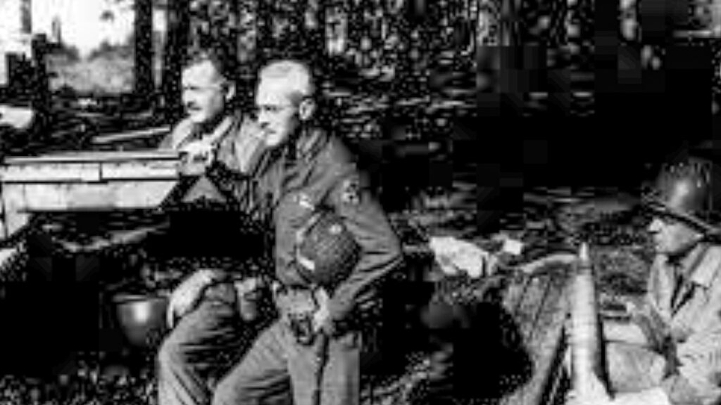
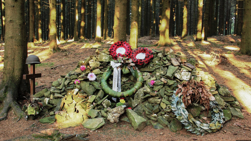
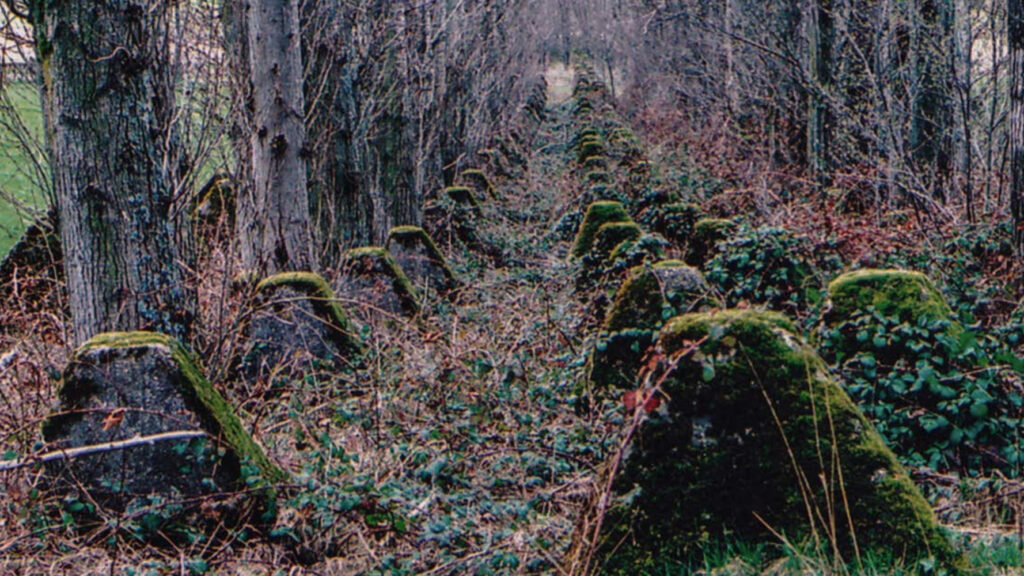
The Hürtgenwald (forest) was the last obstacle standing between US forces and the Rhine River. Yet the decision to advance into the thick forest in September 1944 proved to be a fatal mistake, read more…
The Americans completely miscalculated North Eifel region’s rugged terrain. They became disoriented in an area the German forces, the Wehrmacht, had crisscrossed with trenches and peppered with anti-personnel mines, making the wood into a veritable fortress. Continual rain and fog, followed by snow and frigid temperatures turned the battle into a scene of dystopian butchery.
Author Ernest Hemingway spent 18 days on the front in the Hürtgen forest. He wrote later, “It was a place where it was extremely difficult for a man to stay alive even if all he did was be there”.
Specific local info:


Roman history
Magnus Carolus
Water sources


Nature
WW1
WW2


Local products
Stories
Sleeping suggestions
Public transport:
Industrial heritage:

