Stage 37. Breinig (DE) to Stolberg (DE)

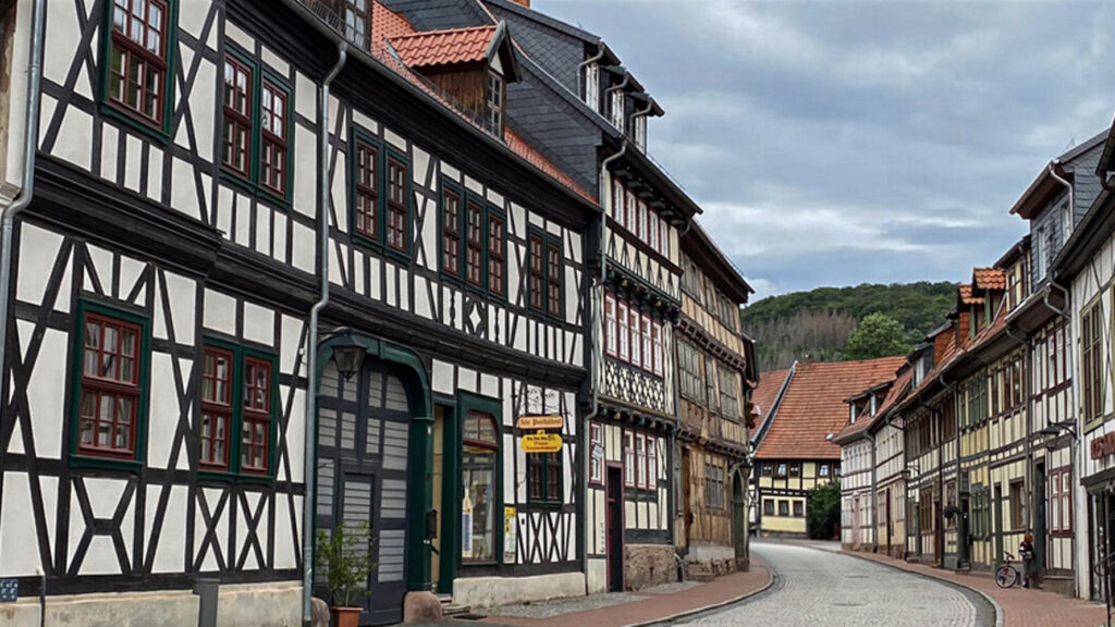
Old Breinig is is today characterised by its urban value and the careful preservation of its historic buildings. The entire old Breinig street is therefore listed as historic town center and designated as a particularly regionally typical place.
In 1880 the Stolberg-Walheim railway line was built by Breinig and in 1889 the Breinig train station which is now a listed building.
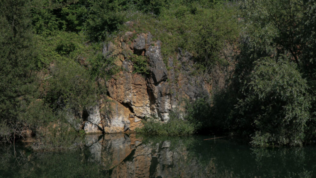
Until 1922, ore was mined in the Cornelia ore mine in the Breiniger Heide area. Many Breinigers worked in the lead and zinc smelters.
On September 14, 1944 US tanks advanced into Breinig.
Old Breinig is is today characterised by its urban value and the careful preservation of its historic buildings. The entire old Breinig street is therefore listed as historic town centers and designated as a particularly regionally typical place.
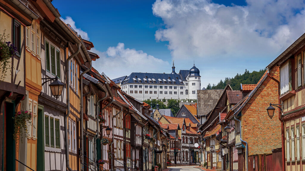
The buildings in the historic centre were mainly built with bluestone from the local quarry,
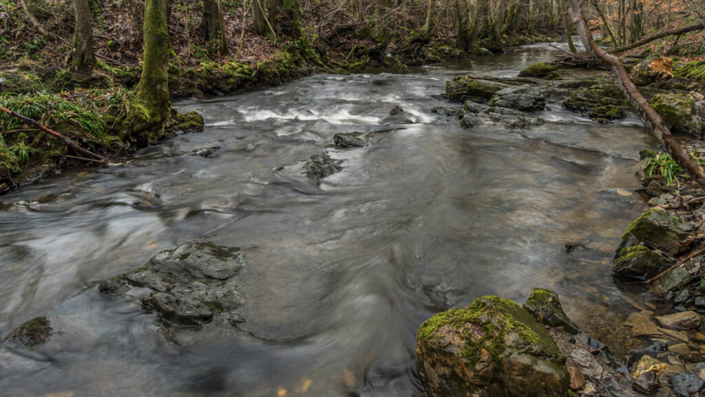
The historic centre of the village is a vital and lively residential area. Nestled in the idyllic surroundings, characterised by cattle meadows and wooded areas, renaturalised streams and former quarries with rugged and moss-covered cliffs. Breinig is strongly promoted by local tourism.
From here the view opens up into the wooded Nature Park Hohes Venn-Eifel around Germany’s youngest national park: the Eifel National Park.
The nicknames of Stolberg are “Copper city” and “Oldest Brass city in the world”, indicates the long tradition of its metalworking industry.
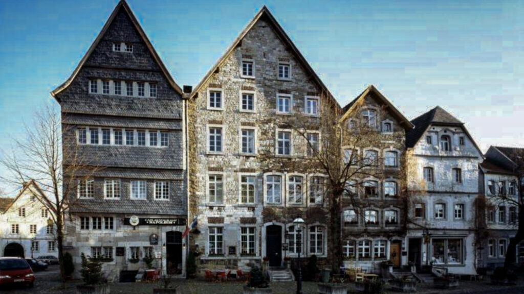
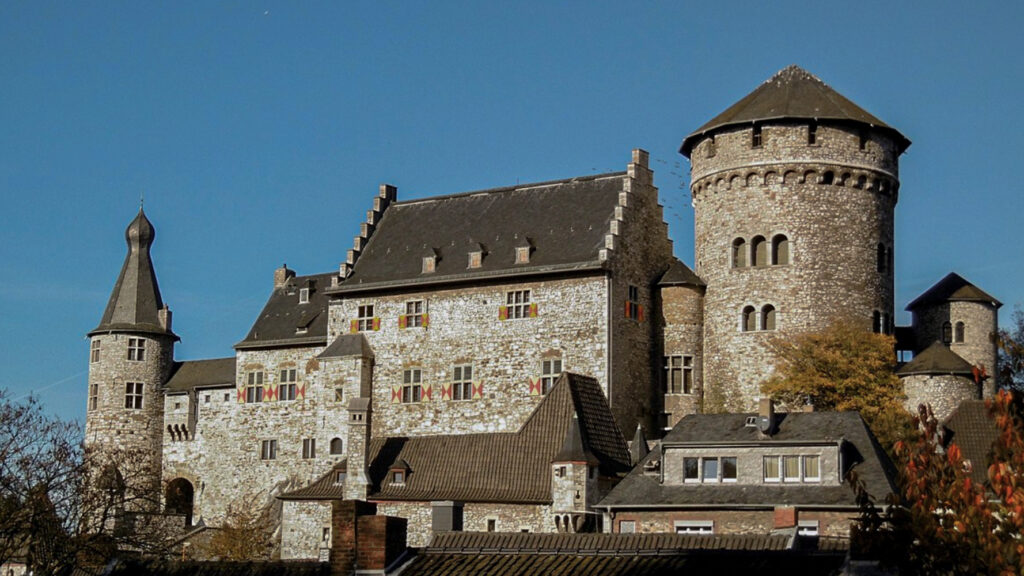
Stolberg is a historic old town with an impressive castle complex, three old town churches and pre-industrial homes and workplaces. The castle complex dates back to the 12th century and there are many other buildings and streets to explore. The appearance of the old town is predominantly determined by the local limestone and the edging of windows and doors are often made of bluestone, which results in visually attractive house facades. The old town encloses the southern and western flank of the castle.
The oldest surviving half-timbered house can still be admired in Klatterstraße and the building with house number 12 is from the 18th century and served as a brewery.
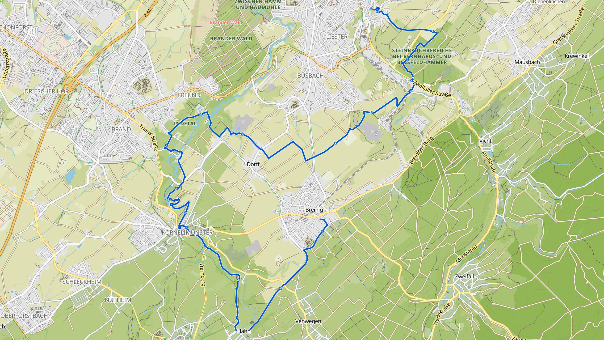
Overview map:
Stats:
| Start: | Breinig (DE) |
| Coordinates (DD): | 50.729983 / 6.220672 |
| End: | Stolberg (DE) |
| Coordinates (DD): | 50.766811 / 6.233552 |
| Distance: | 20,1 kilometers |
| Uphill: | 250 meters |
| Downhill: | 320 meters |
| Path, dirt road, gravel, nature trail: | 73% |
| Asphalt, road: | 27% |
| More additional info like GPX track: | Go to Komoot* page here… (external) |
| Print: | Click Go for download here… (pdf) |
- *Komoot is a navigation and route-planning app that enables you to create and follow routes that are based on walking/riding type and ability. Be aware you have to sign up for free to have access to the app.
See and share with QR code:

You will see stage 37. when you scan the QR code (In the app Komoot).
Highlights:
Kornelimünster started as a small settlement and a sanctuary on the crossroad of two Roman highways crossed, the one from Aachen to Trier and the one from Cologne/Köln via Jülich to Dinant, read more…
Kornelimünster started as a small settlement and a sanctuary on the crossroad of two Roman highways crossed, the one from Aachen to Trier and the one from Cologne/Köln via Jülich to Dinant.
The Benedictine abbey of Kornelimünster was founded in 813/814 by Lodewijk the Pious (778-840), a son of Charlemagne/Carolus Magnus. From the chapel in Aachen, Lodewijk the Pious took the loincloth of Jesus (Linteum Domini), a grave cloth (Sindon Mundi) and a sweat cloth (Sudarium Domini). With the result that Kornelimünster became soon a place of pilgrimage.
Kornelimünster is further located in the valley of the river Inde. In the middle of Kornelimünster is the central market with beautiful bourgeois houses from the 17th and 18th century. The building material is the so-called bluestone and a coal limestone. The houses are mostly covered with slates. The first floor of the houses are often higher than street level because the houses have cellars. The wine that grew on the Burgberg was stored here, among other things. Pulleys show that in the past the goods were also stored on the attics.
Specific local info:


Roman history
Magnus Carolus
Water sources


Nature
WW1
WW2


Local products
Stories
Sleeping suggestions
Public transport:
Industrial heritage:

